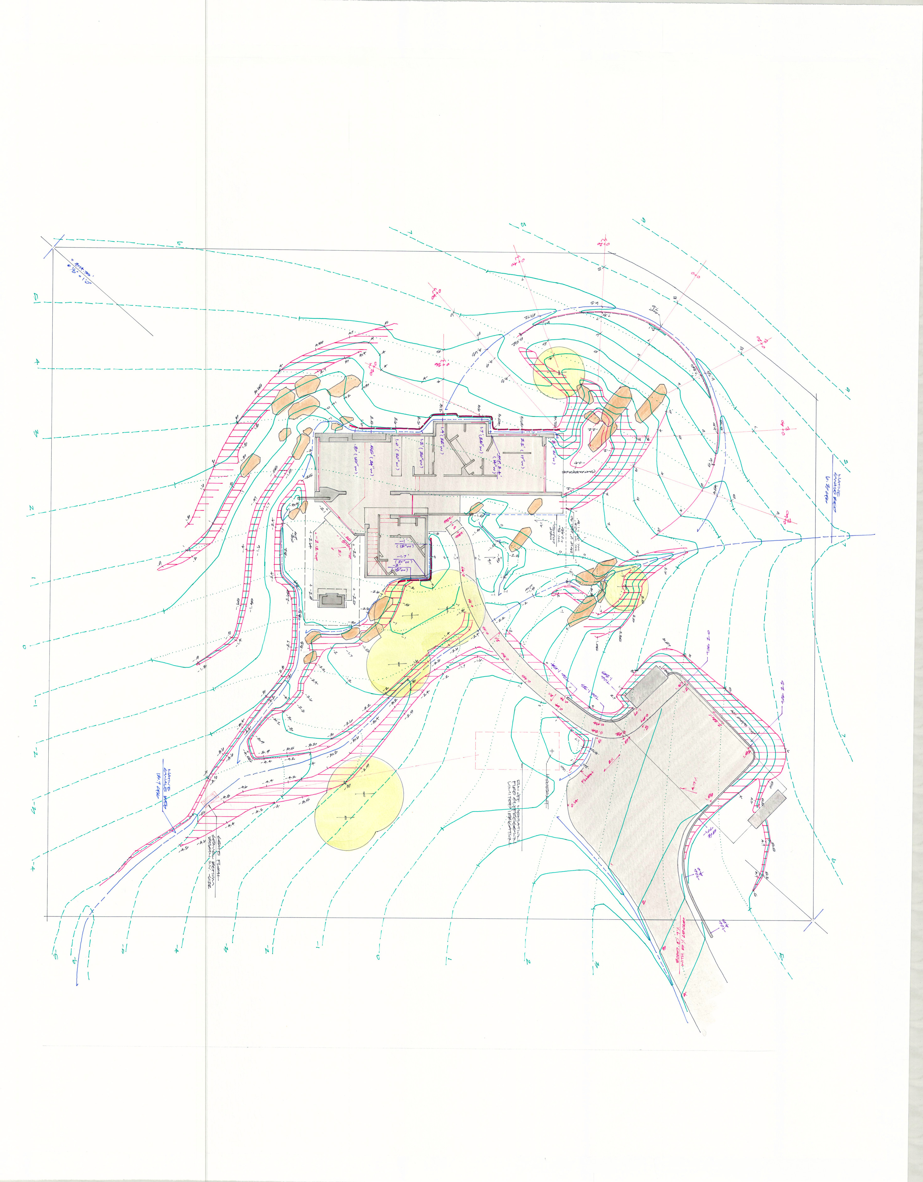
Grading plan
An architect friend coined and printed a tee shirt that he wore in design studio at Yale – “If you can’t turn a fuckup into a feature…get out of the business.” Perhaps a process that reduces fuckups would be good.
Development of a detailed grade map is a best method for integrating civil functions, client program elements and aesthetic landforms in a controlled evaluated process. Less specific maps and hope for a sensitive build exposes the project to many situational limitations that could be avoided.
Effort invested to draw a detailed grade solution allows;
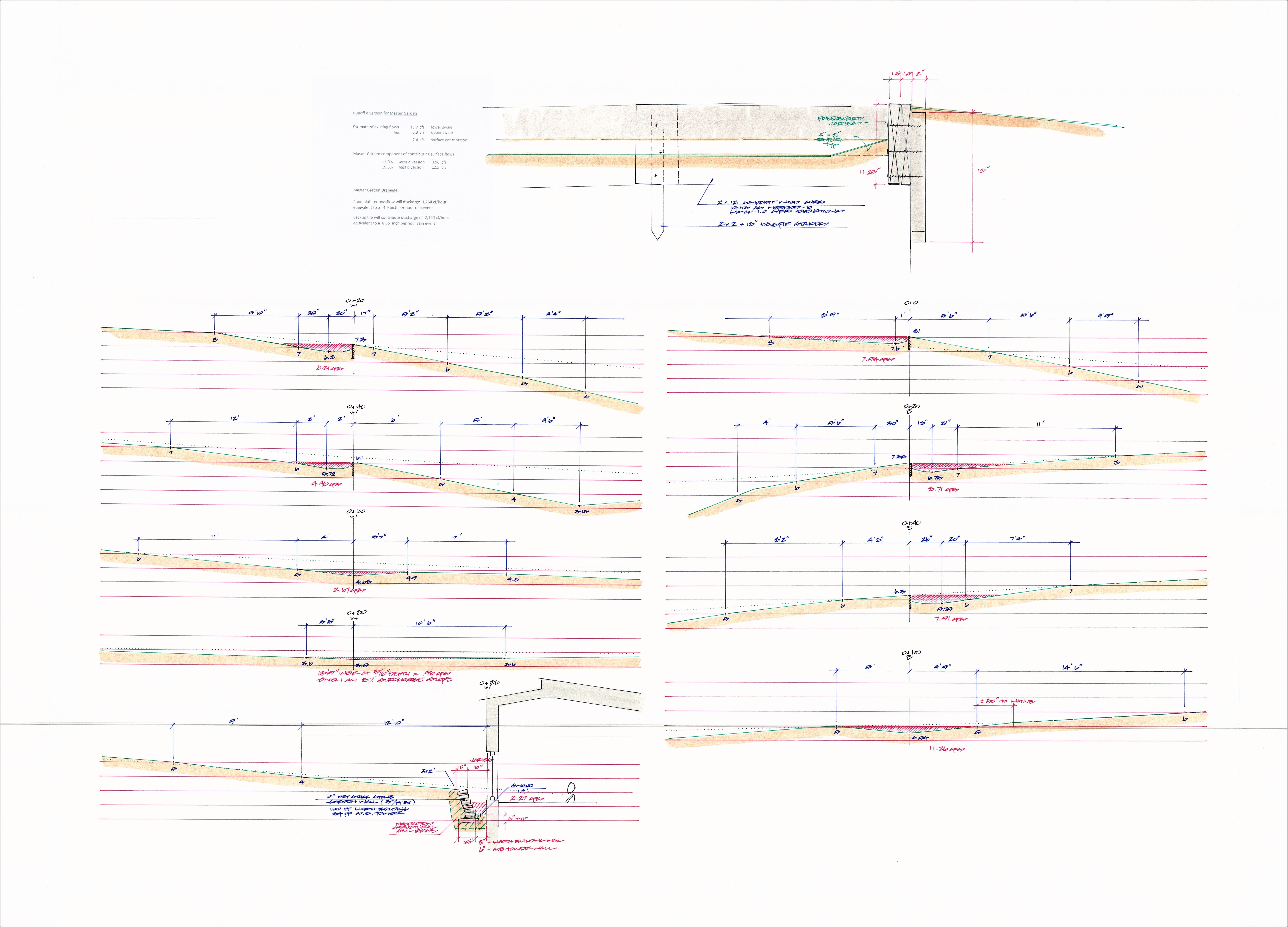
The precise location of critical spot elevations to be grade staked.
The possibility for an efficient build – saving construction time and money.
Micro-environments to be established that both conserve resources and contribute to successful habitats.
Ensures built drainages will perform as intended.
And that constructed elements receive proper cover – exposure satisfying structural issues while maximizing desirable presentation.
A detailed grade plan also allows accurate visualization during architectural design development so that the best presentation opportunities are attained in design illustrations, models and ultimately experienced in the final build.
A detailed grade solution would show;
Topography lines that accurately represent the envisioned finish landform.
Important surface folds would be called out. A fold is where one incline breaks into a different slope for an intended visual effect.
Swale invert and shoulder elevations are accurately drawn and labeled so that the constructed profile effectively evacuates the required water volumes identified in civil discovery.